Scott A. Minnick, NOAA, Wakefield, VA
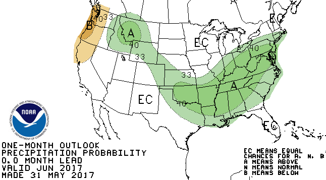
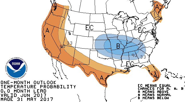
For the second straight year, a wet and generally cool May had a significant impact on planting. Much of the state of Maryland received over 125 to 150 percent of normal rainfall for the month. Temperatures were generally right around normal to below normal, but stubborn cloud cover during the month limited light exposure for growing crops. The benefit from May 2017 was the elimination of remaining D-0 drought conditions left from a dry start to spring. The wet trend of May is expected to dwindle through the first few weeks of June, but overall seasonably cool temperatures are expected to persist through the first half of the month. Thereafter, long range guidance indicates a return to seasonably warm conditions. With a cool start expected and a warm end to the month, the Climate Prediction Center predicts equal chances for above, below, and near normal temperatures overall for June. Average daytime highs warm into the mid 80’s by the end of June. Overnight lows warm into the mid 60’s by the end of the month. Following the wet trend from May and looking ahead, the Climate Prediction Center predicts increased probabilities for above normal rainfall. Normal rainfall for the month of June across the state is around 3 to 4 inches.
 Meteorological summer begins June 1, while calendar summer begins June 21. Also starting in June is the Atlantic Hurricane Season. The National Hurricane Center predicts another active year with above normal activity. The prediction is for 11-17 named storms, with 5-9 of those storms becoming hurricanes. 2-4 of those named storms are forecast to become major hurricanes. The above normal forecast is due to weak, or non-existent El-Nino in the Pacific and warm waters across the tropical Atlantic and Caribbean. The peak of the season occurs in September.
