Scott A. Minnick, NOAA- National Weather Service, Wakefield, VA
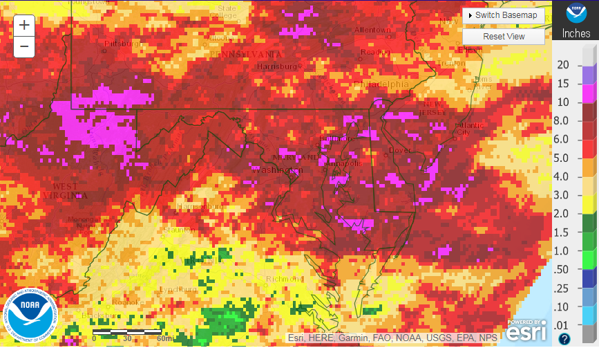
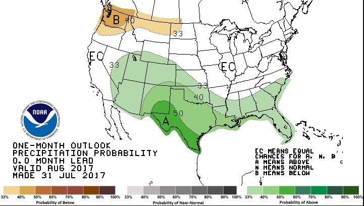
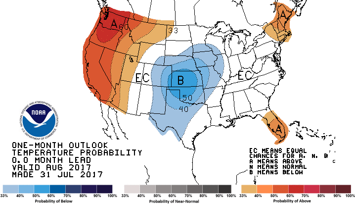
July ended as one of the wettest and warmest Julys on record across the state. Salisbury ended the month at 11.31 inches, which was nearly seven inches above normal for the month and nearly an inch above the previous July record. Average monthly rainfall totals across the state averaged six to eight inches with localized amounts up to ten inches. Much of the rainfall came during the last week of July as a rare, strong low pressure system brought widespread rainfall to much of the Mid-Atlantic region. Above normal precipitation and near normal temperatures are expected to persist through at least the middle of August. However, long term guidance indicates that warmer and drier conditions may return for the latter half of the month. The result is a forecast from the Climate Prediction Center of equal chances for above, below, or near-normal temperatures and rainfall for the month. Average rainfall across the state averages three to four inches in August, making it one of the drier months of the year. As the sun angle decreases and days get shorter, average daytime temperatures fall from the mid to upper 80’s during early August into the low to mid 80’s by the end of the month. Average nighttime temperatures drop into the low 60’s by late August. August marks the last month of meteorological summer.
The Atlantic hurricane season begins to ramp up August into September. With the remnants of Emily tracking across the Florida Peninsula on August 1, we are already up to five named storms for the season. Medium and long range guidance indicates little activity in the Atlantic, but as we all know, these forecasts can change quickly.