Scott Minnick, NOAA- Wakefield

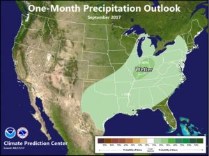
August offered some much needed summer relief following one of the warmest Julys on record. Temperatures ended the month near to below normal. Rainfall varied across the state, averaging generally below normal west to above normal east. The lower Maryland Eastern Shore was the rainfall winner again in August, with amounts of 8 to 12+ inches for the month. As of August 30, Salisbury has recorded 12.23 inches f or the month, nearly 8 inches above normal. Medium range guidance indicates that an active pattern for the Northeast and Mid-Atlantic will continue through mid-September. This will push several fronts into the region, providing opportunities for rainfall. Beyond mid-September, guidance indicates that the active pattern could wane. The call from the Climate Prediction Center is for near normal to slightly above normal temperatures for the month.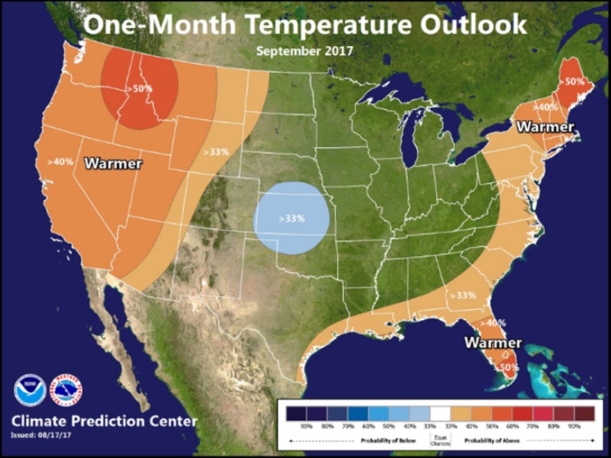
Precipitation depicts increased probabilities for above normal precipitation. Rainfall for the month of September is highly variable, depending on any potential impacts from tropical systems. Normal rainfall is roughly 3-4 inches. Temperatures begin to drop off sharply in September, with daytime highs generally around 80 to begin the month and dropping to around 70 at the end of the month. Lows are generally around 60 the beginning of September, dropping to around 50 at the end of the month.
September 1 marks the beginning of meteorological fall. Calendar fall begins on September 22. September is also the peak of the Atlantic hurricane season. With Hurricane Harvey fresh on everyone’s mind, if you haven’t already, now would be a great time to come up with a plan and be prepared for any tropical system that impacts the Mid-Atlantic.