Jarrod O. Miller, Extension Agronomist
University of Delaware
While some precision agriculture software provides soil maps as a layer along with satellite imagery and yield maps, information on soil types is free and accessible to all growers. Soil surveys have be digitized and are available to anyone with an internet connection.
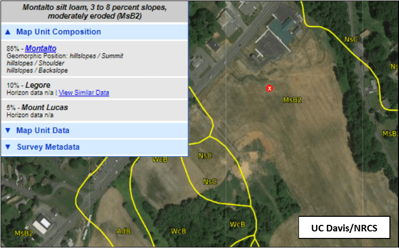
Web soil survey is one option to review soil types, but a more user-friendly website is UC Davis Soil Web (https://casoilresource.lawr.ucdavis.edu/gmap/). Sitting at a home computer, anyone can find fields by typing in an address to observe a satellite photo with soil boundaries. Standing in any field, a cellphone with good reception can zoom to the location you are standing. Soil maps are the easiest way to check under your feet without digging.
In Figure 1 we can observe a field south of the Harford County Extension office. Using the mouse or your cellphone touch screen, select the field/soil map unit will create a red (x) and bring up the soil series names (on the left of Figure 1). There may often be many choices for soil series, reflecting the variability in the field. Choosing the dominant soil name would be valid for general observations. South of the Harford Extension Office (Figure 1), the MsB2 map unit is dominated by the Montalto soil (85%).
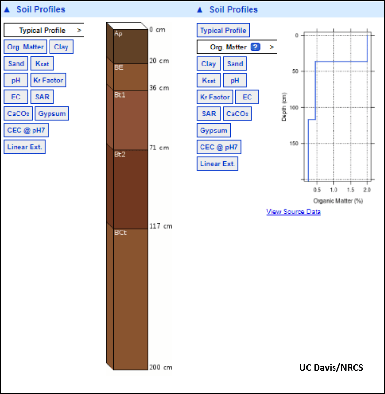
By selecting the Montalto series (clicking the name in blue), a soil profile with horizon names and colors appears (Figure 2). Next to the soil profile are other options you can select, including particle size or organic matter content with depth. The organic matter content of the Montalto seires (Figure 2) is expected to be 2% at the surface, quickly dropping to less than 0.5% below 50 cm (20 inches). This doesn’t mean the entire field has this much organic matter, but it is good for comparing soils under production. These soil maps can be useful to those who want to explain differences in yield or growth across their farms, and can be used as an additional guide to soil sampling. If you would like help exploring these soil maps, contact your county extension office.